


![31 Top Social Media Platforms in 2025 [+ Marketing Tips]](https://static.semrush.com/blog/uploads/media/0b/40/0b40fe7015c46ea017490203e239364a/most-popular-social-media-platforms.svg)


![[Webinar] AI Is Already Inside Your SaaS Stack — Learn How to Prevent the Next Silent Breach](https://blogger.googleusercontent.com/img/b/R29vZ2xl/AVvXsEiOWn65wd33dg2uO99NrtKbpYLfcepwOLidQDMls0HXKlA91k6HURluRA4WXgJRAZldEe1VReMQZyyYt1PgnoAn5JPpILsWlXIzmrBSs_TBoyPwO7hZrWouBg2-O3mdeoeSGY-l9_bsZB7vbpKjTSvG93zNytjxgTaMPqo9iq9Z5pGa05CJOs9uXpwHFT4/s1600/ai-cyber.jpg?#)


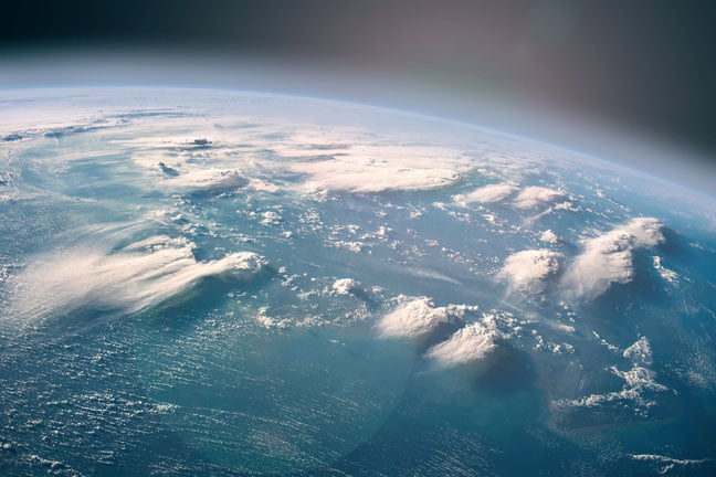
The world’s biggest space-based radar will measure Earth’s forests from orbit
Forests are the second-largest carbon sink on the planet, after the oceans. To understand exactly how much carbon they trap, the European Space Agency and Airbus have built a satellite called Biomass that will use a long-prohibited band of the radio spectrum to see below the treetops around the world. It will lift off from…
Forests are the second-largest carbon sink on the planet, after the oceans. To understand exactly how much carbon they trap, the European Space Agency and Airbus have built a satellite called Biomass that will use a long-prohibited band of the radio spectrum to see below the treetops around the world. It will lift off from French Guiana toward the end of April and will boast the largest space-based radar in history, though it will soon be tied in orbit by the US-India NISAR imaging satellite, due to launch later this year.
Roughly half of a tree’s dry mass is made of carbon, so getting a good measure of how much a forest weighs can tell you how much carbon dioxide it’s taken from the atmosphere. But scientists have no way of measuring that mass directly.
“To measure biomass, you need to cut the tree down and weigh it, which is why we use indirect measuring systems,” says Klaus Scipal, manager of the Biomass mission.
These indirect systems rely on a combination of field sampling—foresters roaming among the trees to measure their height and diameter—and remote sensing technologies like lidar scanners, which can be flown over the forests on airplanes or drones and used to measure treetop height along lines of flight. This approach has worked well in North America and Europe, which have well-established forest management systems in place. “People know every tree there, take lots of measurements,” Scipal says.
But most of the world’s trees are in less-mapped places, like the Amazon jungle, where less than 20% of the forest has been studied in depth on the ground. To get a sense of the biomass in those remote, mostly inaccessible areas, space-based forest sensing is the only feasible option. The problem is, the satellites we currently have in orbit are not equipped for monitoring trees.
Tropical forests seen from space look like green plush carpets, because all we can see are the treetops; from imagery like this, we can’t tell how high or thick the trees are. Radars we have on satellites like Sentinel 1 use short radio wavelengths like those in the C band, which fall between 3.9 and 7.5 centimeters. These bounce off the leaves and smaller branches and can’t penetrate the forest all the way to the ground.
This is why for the Biomass mission ESA went with P-band radar. P-band radio waves, which are about 10 times longer in wavelength, can see bigger branches and the trunks of trees, where most of their mass is stored. But fitting a P-band radar system on a satellite isn’t easy. The first problem is the size.
“Radar systems scale with wavelengths—the longer the wavelength, the bigger your antennas need to be. You need bigger structures,” says Scipal. To enable it to carry the P-band radar, Airbus engineers had to make the Biomass satellite two meters wide, two meters thick, and four meters tall. The antenna for the radar is 12 meters in diameter. It sits on a long, multi-joint boom, and Airbus engineers had to fold it like a giant umbrella to fit it into the Vega C rocket that will lift it into orbit. The unfolding procedure alone is going to take several days once the satellite gets to space.
Sheer size, though, is just one reason we have generally avoided sending P-band radars to space. Operating such radar systems in space is banned by International Telecommunication Union regulations, and for a good reason: interference.
“The primary frequency allocation in P band is for huge SOTR [single-object-tracking radars] Americans use to detect incoming intercontinental ballistic missiles. That was, of course, a problem for us,” Scipal says. To get an exemption from the ban on space-based P-band radars, ESA had to agree to several limitations, the most painful of which was turning the Biomass radar off over North America and Europe to avoid interfering with SOTR coverage. “This was a pity. It’s a European mission, so we wanted to do observations in Europe,” Scipal says. The rest of the world, though, is fair game.
The Biomass mission is scheduled to last five years. Calibration of the radar and other systems is going to take the first five months. After that, Biomass will enter its tomography phase, gathering data to create detailed biomass maps of the forests in India, Australia, Siberia, South America, Africa—everywhere but North America and Europe. “Tomography will work like a CT scan in a hospital. We will take images of each area from various different positions and create the 3D map of the forests,” Scipal says.
Getting full, global coverage is expected to take 18 months. Then, for the rest of the mission, Biomass will switch to a different measurement method, capturing one full global map every nine months to measure how the condition of our forests changes over time.
“The scientific goal here is to really understand the role of forests in the global carbon cycle. The main interest is the tropics because it’s the densest forest which is under the biggest threat of deforestation and the one we know the least about,” Scipal says. Biomass is going to provide hectare-scale-resolution 3D maps of those tropical forests, including everything from the tree heights to ground topography—something we’ve never had before. But there are limits to what it can do.
“One drawback is that we won’t get insights into seasonal deviations in forest throughout the year because of the time it takes for Biomass to do global coverage,” says Irena Hajnsek, a professor of Earth observation at ETH Zurich, who is not involved in the Biomass mission. And Biomass is still going to leave some of our questions about carbon sinks unanswered.
“In all our estimations of climate change, we know how much carbon is in the atmosphere, but we do not know so much about how much carbon is stored on land,” says Hajnsek. Biomass will have its limits, she says, since significant amounts of carbon are trapped in the soil in permafrost areas, which the mission won’t be able to measure. “But we’re going to learn how much carbon is stored in the forests and also how much of it is getting released due to disturbances like deforestation or fires,” she says. “And that is going to be a huge contribution.”


![How to Find Low-Competition Keywords with Semrush [Super Easy]](https://static.semrush.com/blog/uploads/media/73/62/7362f16fb9e460b6d58ccc09b4a048b6/how-to-find-low-competition-keywords-sm.png)